Earth’s Biggest Volcanic Eruptions  —  A Lean, Human Read

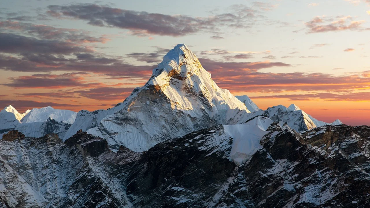
How we size “largest”

Scientists mostly use the Volcanic Explosivity Index (VEI), a log scale where each step is ~10× more erupted material. VEI-8 sits at the summit — short, rare, planet-shaping. But volumes are estimates, plume heights get revised, and dates tighten with new labs. Translation: any top-10 is smart, not sacred.

Supereruptions (VEI-8)

Toba  —  ~74,000 years ago, Sumatra

Caldera collapse, lake born from the scar, ash tracked across the Indian Ocean rim. Its glass shards show up in far-off cores. Enormous. Abrupt. Climate-nudging.

Taupō (Oruanui)  —  ~26,500 years ago, New Zealand

A multipart sequence — falls, ignimbrites, final collapse — that rewired the central North Island. Later Taupō events? Still punchy, never Oruanui-big.

La Garita  —  ~28 million years ago, Colorado, USA

Source of the Fish Canyon Tuff: a broad, surprisingly uniform ignimbrite sheet. That uniformity whispers “fast, high-volume discharge” from a giant magma body.

Historic heavy-hitters (VEI ≥6)

Tambora  —  1815, Indonesia (VEI-7)

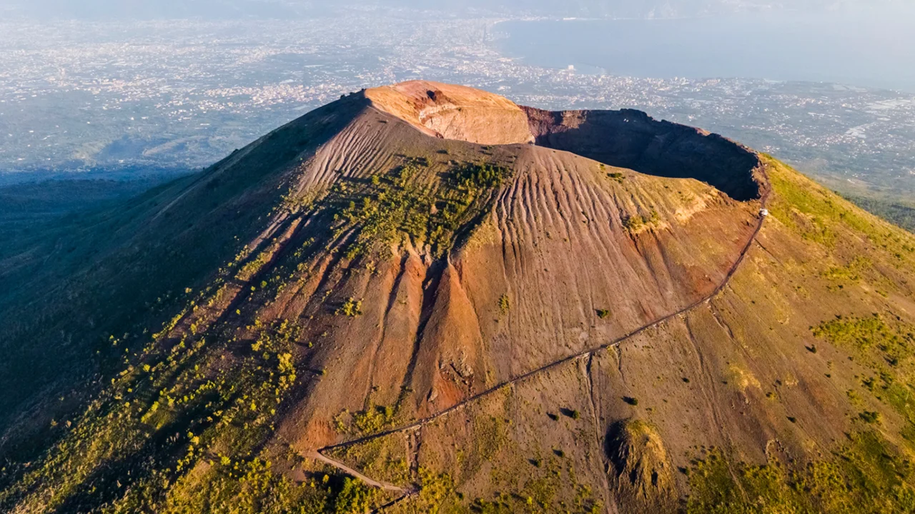
The largest in written history. Stratospheric aerosols helped set up 1816’s “Year Without a Summer.” Today a wide caldera rims Sumbawa. Hard to miss.

Krakatau  —  1883, Indonesia (VEI-6)

Runaway blasts, caldera collapse, tsunamis. Barometers worldwide twitched as pressure waves lapped the globe; sunsets went weirdly vivid. Anak Krakatau later grew in the gap.

Novarupta  —  1912, Alaska, USA (VEI-6)

Twentieth-century champ. Ash-flow tuffs paved the Valley of Ten Thousand Smokes; steam vented for years after. Stark, ash-grey country.

Pinatubo  —  1991, Philippines (VEI-6)

Well-forecast crisis. Sulfate aerosols cooled global temps for a few seasons. The long tail? Lahars that woke up every rainy year. Risk didn’t end when the ash fell.

Lava floods: huge, just different

Flood-basalt provinces don’t throw sky-high plumes; they stack lava. The Deccan Traps rose in pulses over long spans, building thick plateaus. Immense total mass, modest VEI. “Largest,” here, means area and tonnage — not fireworks.

Why lists wobble

Methods, dates, definitions

Bulk tephra or dense-rock equivalent? One vent or a stitched multi-phase episode? New ages, better mapping, revised plume heights — shuffle, shuffle. So rankings move. The story remains: a handful of eruptions bent the climate, redrew coasts, and left rock records legible across continents.

Quick takeaway

VEI is a useful yardstick. Context rules. Style, duration, aftermath — those decide how each giant actually changed the world.

Mount Vesuvius: Where It Is, Why It’s Famous — and How to See It

South of Naples, above the glittering Bay, rises Mount Vesuvius. Ancient menace, modern landmark. Still quiet—yet not finished. Curious? You should be.

A Volcano That Rewrote History

AD 79: cities sealed in ash

Late summer of 79 CE—some argue August 24, others point to late October. A column soared, then collapsed. Pompeii and Oplontis smothered by ash; Herculaneum overtaken by super-hot surges. Streets, frescoes, even loaves in ovens—stopped mid-life. Pliny the Younger’s letters turned eyewitness shock into the first scientific description of a Plinian eruption. What a source!

1631–1944: restless centuries

After antiquity, Vesuvius kept returning. The 1631 outburst killed thousands around the cone. The 1906 eruption wrecked roofs under ash loads; lava cut roads. And in March 1944—during WWII!—lava and bombs shared the same sky as flows damaged villages like San Sebastiano and aircraft at nearby fields. Since then: a lull, not extinction.

Geography and Structure

Somma–Vesuvius: a volcano within a volcano

Look closely: the younger cone sits inside the crescent of Monte Somma. This somma-stratovolcano tells its story in layers—lava, scoria, pale ash bands—each marking a pulse. The crater rim is broad, fractured, breathing faint fumaroles on cool days.

Height, type, setting

Elevation hovers around 1,280 m, although it changes after big events. Classic stratovolcano profile, steep and symmetric from afar. It stands amid the Campanian volcanic arc, where complex plate motions feed magma, chemistry, and, yes, risk.

Where It Is and How to Visit

Getting there today

How close to a big city? Shockingly close—about 15 km from Naples. The peak lies within Vesuvius National Park (established 1995). Most visitors drive or bus to ~1,000 m, then hike a signed path to the rim. Ten to forty minutes, depending on pace. Wind whips. Views stun.

Practical notes

Entry is ticketed; slots can sell out in high season. Hours shift with daylight—short in winter, longer toward July–August. Wear sturdy shoes. Bring water. Weather turns fast; clouds can erase the bay in minutes. And remember: this is an active system—obey closures without debate.

Why Scientists Watch It

Monitoring and new discoveries

Naples hosts the world’s oldest volcano observatory (founded 1841) to track quakes, gas, and ground swell. Meanwhile, archaeology keeps yielding specifics: charred Herculaneum scrolls partially read with advanced imaging; evidence of intense heat effects on organic remains. Grim? Yes. Invaluable for science.

So—what makes Vesuvius special?

Scale of the AD 79 catastrophe. Proximity to a metropolis. A landscape where vineyards root in ash while instruments hum. Beauty and hazard, side by side. Respect is mandatory!

Krakatoa and the day the sky tore open

An island that vanished in hours

On 26 August 1883 the volcano in the Sunda Strait roared to life. Not a single burst, a series. Towers of ash climbed far above cruising altitudes, daylight dimmed, and thunder rolled inside the cloud itself. By dawn on 27 August the island of Krakatoa was breaking apart. Sailors staggered on decks, some with ruptured eardrums. People on Java and Sumatra watched the sea pull back, puzzled for a heartbeat, then terrified. What followed felt like the end of time.

The loudest sound many humans ever heard

Reports came from Fremantle, from Batavia, from the remote island of Rodrigues in the Indian Ocean. An audible footprint close to five thousand kilometers. Near the source there was only pain, then ringing, then silence. Contemporary instruments and later reconstructions point to shock levels that would shatter windows and bodies alike. Barometers jumped in unison across Asia and then Europe, a planetary wince recorded in neat ink lines.

The atmosphere rang like a bell

Meteorological logs kept by careful clerks tell a strange story. A pressure pulse arrived, then returned, then returned again. Cities counted multiple passes, some up to seven. Each lap took roughly thirty four hours, a global echo that turned the whole sky into a resonant chamber. Imagine a bell, struck once, humming for days. That was the air after Krakatoa.

Tsunami that erased shorelines

Water answered the air. Waves as high as a ten story building smashed through villages along Java and Sumatra. Coral blocks the size of cottages were tossed inland. More than thirty thousand people died, perhaps far more, the count uncertain because officials, families, and whole archives vanished with the flood. Lighthouses toppled. Rice fields filled with salt. In places where the wave met a narrow bay, destruction was absolute.

Power on the scale of megatons

How much energy did this require? Modern comparisons put the paroxysmal phase in the ballpark of scores of megatons of TNT. The island did not simply vent, it collapsed into a caldera as magma chambers emptied. Charts of the strait had to be redrawn. New shoals appeared. Navigation routes shifted. A map updated by force.

Ash, sulfur, and a cooler year

Fine ash and sulfur dioxide broke into the stratosphere and hitched a ride on global winds. Sunlight scattered off sulfate aerosols. Result, a measurable drop in average temperature across large parts of the world in 1884. Harvests faltered in some regions, while skies performed nightly theater. Crimson sunsets. A violet halo around the sun is called a bishop’s ring. The Moon sometimes looked blue when ash filtered out the red end of the spectrum. Fire brigades, fooled by lurid evening light, raced toward horizons that were not burning.

Art, memory, and a scream in paint

Writers reached for the language of omens. Painters looked up and changed their palettes. Northern skies in the months after the eruption match the strange blood reds that haunt late nineteenth century canvases. Edvard Munch later wrote about a sky that set his heart trembling. The mood fits the documented optics. Nature staged expressionism before the term existed.

Krakatoa beside other giants

Tambora in 1815 still stands as the bigger climate disrupter, the trigger of the Year Without a Summer in 1816 with crop failures across the North Atlantic world. Krakatoa, smaller in total ejecta, was swifter and more explosive, a detonation that left cleaner fingerprints in sound and wave records. Both together remind us that the Indo Pacific is not quiet ground. The neighborhood has weather, art, famine, and migration.

Eyewitness threads that make the picture real

Sailors logged floating rafts of pumice thick enough to slow a hull. Telegraph offices reported pressure spikes almost identical across countries, a rare synchronized dataset for the nineteenth century. Newspapers printed confused stories of red suns and poisoned rain. Personal diaries confirm the same sequence, fear, awe, a longing to explain. The modern researcher reads these threads and hears a chorus.

Lessons for the present

Volcanoes do not respect borders. A local blast can become a global event within hours. Early warning networks, shared meteorological data, robust coastal evacuation plans, these save lives. Instruments today are faster and far more sensitive. Yet the basic truth holds. When the Earth clears its throat, humanity must listen and respond.

The voice of the strait has not faded

A child of Krakatoa, Anak Krakatau, rose from the sea in the twentieth century and remains active. Its growth, collapses, and renewed eruptions remind us that the system persists. Will there be another sky like 1883. Not inevitable, not impossible. The right mix of magma, water, and pressure can still summon a roar that circles the world. Vigilance matters. So does memory.

Ten Dormant Volcanoes That Could Still Reshape Our World

Dormant ≠ Safe

Silence deceives. In April 1815, Mount Tambora ended roughly a thousand years of calm and pushed 1816 into the “Year Without a Summer.” Snow in June across New England; failed European harvests; migration and hunger. The message endures: dormancy signals a pause, not extinction. Today we deploy GPS, InSAR, and multi-gas sensors—impressive, yes—yet coverage remains uneven, and escalation can compress from months to days. Sometimes… hours! Preparedness, therefore, is policy, not panic.

Ten Systems to Watch—Quiet Surfaces, Busy Interiors

1) Laguna del Maule, Chile

A silicic caldera where the ground rose by decimeters per year in the 2010s. Translation: shallow magma input at only a few kilometers depth. Tourism thrives around the lakes, but contingency drills must keep pace. Better rehearsed than surprised.

2) Uturuncu, Bolivia

A 6,000-meter sentinel with a ~70 km inflation footprint. Slow and steady. Not a red siren—an amber light. Evolved magma implies potential for ash-rich events if conduits open. Remote? Ash clouds travel.

3) Colli Albani (Alban Hills), Italy

Barely 20 km from Rome. Late 20th-century CO₂ bursts and hydrothermal anomalies confirmed active plumbing. Urban density multiplies consequence: even moderate unrest can disrupt rail hubs, ring roads, and utilities. Proximity is the hazard amplifier.

4) Campi Flegrei, Italy

West of Naples. Since 1950: bradyseism cycles, swarms, elevated gas flux. Last eruption—1538—was small; the exposure today is not. Even a modest ash event could strain hospitals, ports, and schools. Vigilance must be continuous.

5) Yellowstone, USA

Famous—and often misunderstood. Annual odds of a cataclysm are tiny, yet uplift–subsidence pulses, microquakes, and vigorous hydrothermal activity show a living system. A small ash-producing episode would still rattle aviation and power across multiple states. Manageable? Yes. Ignorable? No.

6) Mount Fuji, Japan

Dormant since 1707–1708 (Hōei). Beautiful, photogenic, strategically sensitive. Ashfall scenarios for the Kantō plain—Tokyo and beyond—are routinely updated to protect rail arteries and airports. Aesthetic icon; operational challenge.

7) Long Valley Caldera, USA

Mammoth Lakes remembers the 1980s: intense swarms, CO₂ pockets, deformation. Caldera lesson: long repose does not equal retirement. Episodic reactivation remains plausible, therefore planning remains prudent.

8) Askja, Iceland

After the explosive 1875 event—decades of relative quiet. Recently: deformation and clustered quakes. In a rift environment, timelines can collapse. Weeks from tremor to eruption? Possible. Aviation managers take note.

9) Paektu (Baekdu), DPRK/China

Source of a colossal ~940 CE eruption. Uplift, unusual helium ratios, and warm springs hint at renewed recharge. Cross-border science is essential; ash ignores passports. Coordination is a safety tool.

10) Cumbre Vieja, La Palma, Spain

Long present in hazard studies; in 2021 it spoke plainly—lava, SO₂ spikes, mass evacuations, months of ash cleanup. A modern case study in rapid escalation. Lessons learned should not be forgotten.

Comparative Snapshot (indicative)

Volcano (Country)Last Significant EruptionPrimary Current ConcernExposure
Campi Flegrei (IT)1538Ashfall, ground instability, gasVery high (Naples metro)
Mount Fuji (JP)1707–1708Ashfall, laharsVery high (Kantō region)
Yellowstone (US)Holocene minor eventsAsh, hydrothermal blastsModerate (regional)
Paektu/Baekdu (CN/DPRK)~940 CETall ash columns, explosivityModerate–high (cross-border)
Laguna del Maule (CL)HoloceneRapid uplift, silicic blastLow–moderate (rural/visitors)

Note: Schematic overview for quick comparison; operational decisions must follow official observatory guidance.

Signals That Deserve Attention

What usually comes first? Swarms of shallow M1–M4 quakes; accelerating uplift recorded by GPS and InSAR; gas shifts—rising CO₂/SO₂ ratios, elevated ³He/⁴He; warming springs and crater lakes. None guarantees eruption. Yet converging lines of evidence demand action: clear alert levels, pre-staged evacuation routes, ash cleanup logistics, backup power for hospitals and data centers, alternative air corridors. Practice now; improvise less later.

Risk: Uneven—Manageable—Real

Hazard (what a volcano can do) × exposure (who and what is nearby) = risk. Hence Campi Flegrei and Fuji rank high largely due to people and infrastructure, while Askja’s remoteness reduces local impact but can still disrupt North Atlantic flights. Uturuncu? A slow-building narrative—on the watch list, not the panic list.

Conclusion—Vigilance Over Drama

Prediction to the day remains elusive. Prevention of chaos is attainable. With sustained monitoring, open data, and disciplined planning, societies can convert frightening uncertainty into structured resilience. Dormant—yes. Harmless—no. And that is precisely why we stay ready!

Global Seismic Update — A Reporter’s Notebook From A Humming Week

I began today before sunrise, Utrecht still yawning, espresso too hot to sip. Alerts blinked like stubborn fireflies: Aleutians. Taiwan. Hindu Kush. And somewhere in the back row of my brain—the echo of last week’s Southern Ocean heavyweight. Don’t panic. Not even dread. Just that professional hush before the music starts.

What The Dashboard Whispered (And Shouted)

Some days the feed screams; today it negotiated. A few deep shivers, one shallow elbow, and the long after-song from Kamchatka still thumping like a bass you feel through the floorboards. I toggled between agency pages, old habits: double-check the depths, look for outliers, ask the only question that matters—so what changes for people? Often, not much. But sometimes… everything.

Past 48 hours — Distilled To The Signals That Mattered

UTC timeRegionMagDepthWhy it stuck with me
2025-08-28 11:07NE of Amchitka, Alaska5.5121 kmDeep focus; instruments rattled, people mostly didn’t. “Info only.” Exhale.
2025-08-27 13:11Off Yilan, Taiwan5.3–6.0*~112–117 kmSkyscrapers swayed; coffee stayed in the cup. Different agencies, same calm outcome.
2025-08-27 13:27Hindu Kush / Badakhshan5.1~125 kmClassic deep tremor—felt far, breaks little. A lantern chain of “did you feel it?”
2025-08-26 20:33Caspian Sea (NNW of Derbent)5.49 kmShallow and punchy; that one sends folks outside for a minute. Pipelines get a look.

Field notes, not just figures

  • Aleutians. The alert landed mid-bite of a sandwich. I checked tsunami messaging—quiet. Routine deep geometry. Honestly? Boring. Blessedly so.
  • Taiwan. The blinds did that slow dance; chairs rolled half a centimeter; life resumed. Resilience here feels baked-in, like muscle memory you don’t brag about.
  • Hindu Kush. I’ve learned this signature: a deep quiver under high valleys, felt in many places, feared in few.
  • Caspian. Different ballgame. Shallow quakes throw sharper elbows—short, snappy shaking. You check older masonry and keep moving.

The Bigger Arc — A Giant’s After-Song And A Lonely Brute

Last week, 22 Aug, the Southern Drake Passage let loose—a remote, muscular jolt that moved a lot of water and very few headlines. Good. Up north, the Kamchatka/Kuril sequence—born from the late-July megathrust—keeps writing its aftershock paragraphs. As it seems to me, aftershocks aren’t surprises; they’re the bill arriving after the dinner. You knew it was coming; you just didn’t know the exact tip.

Why two “fives” can feel like different planets

FeatureShallow crustal (≤20 km)Intermediate/deep (70–300+ km)
Local damage potentialHigher: punchy, high-frequency hitsLower: energy spreads before reaching surface
Felt areaCompact to regionalBroad—sometimes hundreds of km
This week’s examplesCaspian M5.4 (9 km)Taiwan M5.3–6.0 (~112–117 km)
Practical takeawayInspect masonry & lifelines nearbyExpect swaying; fewer structural issues

I once chased a “small” shallow quake that cracked a century-old façade, and a “bigger” deep one that barely jingled a keychain. Numbers tell; context convinces.

Outlook — Calm Posture, Busy Notebooks

  • Current risk picture. No broad tsunami alerts on my board. Coastal readers: local guidance first, always—it’s faster than any global feed.
  • Where I’d spend the next hour. (1) Keep one eye on Kamchatka/Kurils for M5–M6 aftershocks; (2) quick infrastructure sanity-checks in the Caspian zone; (3) Aleutian deep events—useful diagnostics for sensors even when streets barely notice.
  • Small confession. At 03:49 UTC yesterday, the North Pacific trace jumped and—yes—so did my pulse. Then the models settled, the phones stayed quiet, and the night remembered how to breathe. News, not panic. That, to me, is the craft: alert yet unafraid.